
When the signal ends, Oilfield Route doesn't
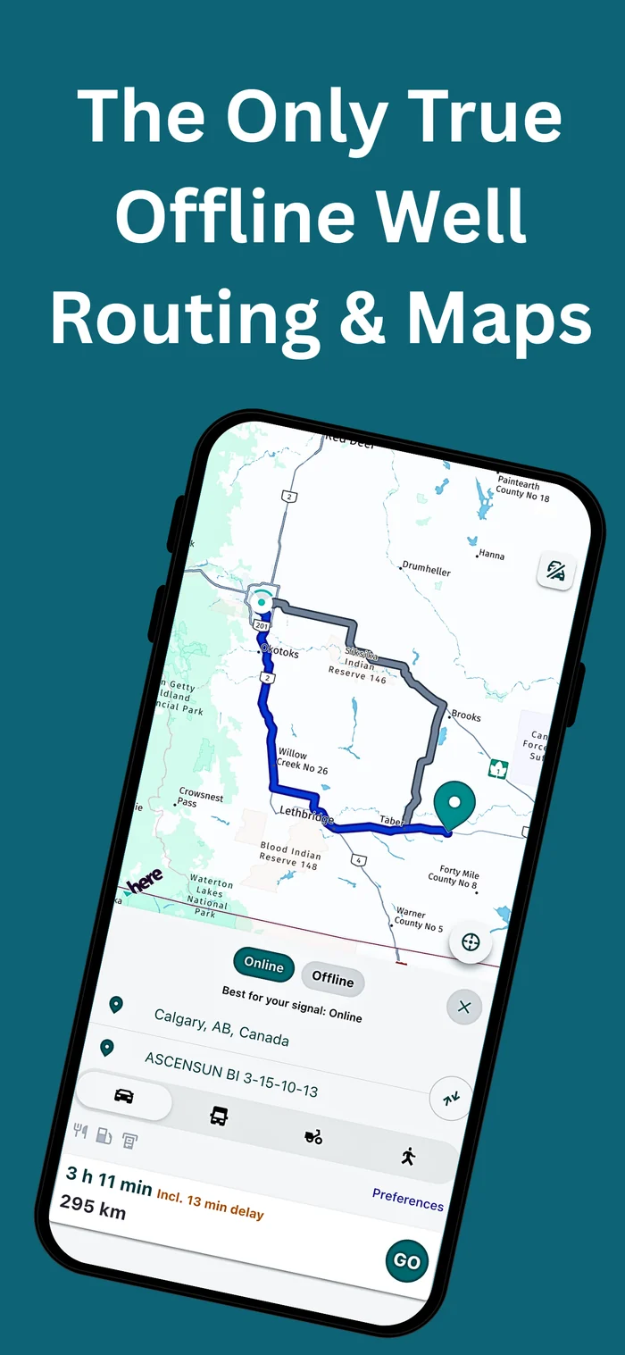
Navigate to any wellsite in Canada or the US - even with zero cell coverage
The only oilfield app where routing works with zero internet - not just a well list. Reliable navigation to get you there and back home safely.
7-days free trial included
THE OFFLINE ADVANTAGE
Other Apps Go Offline. We Stay Offline.
Most oilfield apps claim offline support—but that usually means your well list is cached. The moment you need a route, they need a signal. Cached-route tools can preload a path before you leave, but if you reroute or lose that cache, you're stranded. Oilfield Route is different: download your region once and everything works with the phone in airplane mode.
| Closest Competitor | Oilfield Route |
|---|---|
|
|
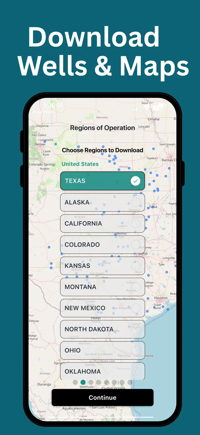
Download your region
Grab the full map once for your region(s) over WiFi or internet.
Watch demo on YouTubeGo fully offline
Once you're in the field, you won’t need signal again. Search wells, look up LSDs, and plan your route.
Watch demo on YouTubeNavigate with confidence
Full turn-by-turn directions with rerouting even in airplane mode or fully offline.
Watch demo on YouTubeTrue Offline Navigation
Pro Plan Only
Professional Well & Land Data
Essential and Pro Plans
Built for Real Field Conditions
Essential and Pro Plans
Used Across Canada & the U.S.
Essential and Pro Plans
Built for Professionals Who Work Beyond Signal
Every feature designed with real field conditions in mind
Essential includes core field tools like well search, location sharing, and professional well data. Pro also includes offline navigation and vehicle-optimized routes.
True Offline Navigation
Pro Plan OnlyDownload maps once and navigate with full turn-by-turn directions — even with zero cell signal. Designed for remote oilfield access where connectivity isn't an option.
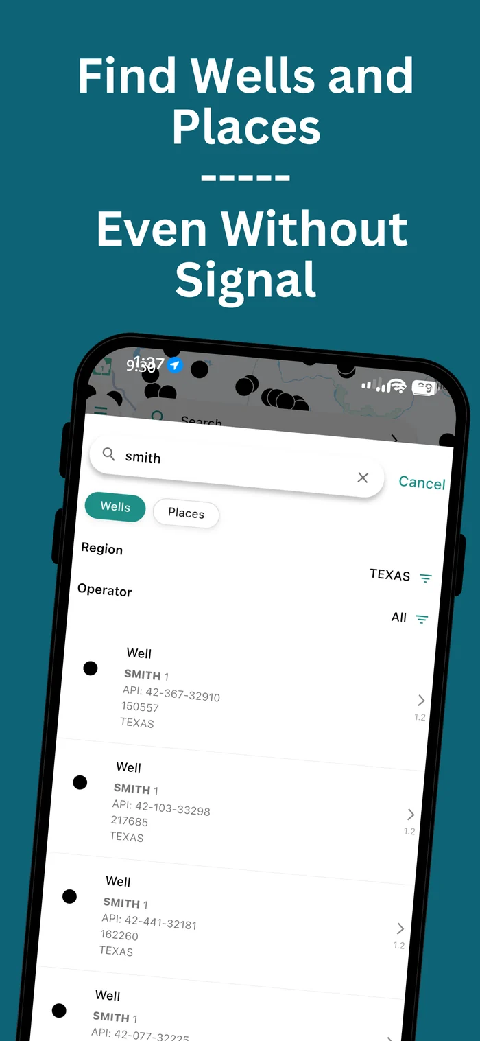
Powerful Well & Land Search
Quickly locate oil & gas wells using Well Name, UWI, or API. Use smart land descriptions like DLS-LSD, NTS, and PLSS to pinpoint locations across Canada and the U.S.
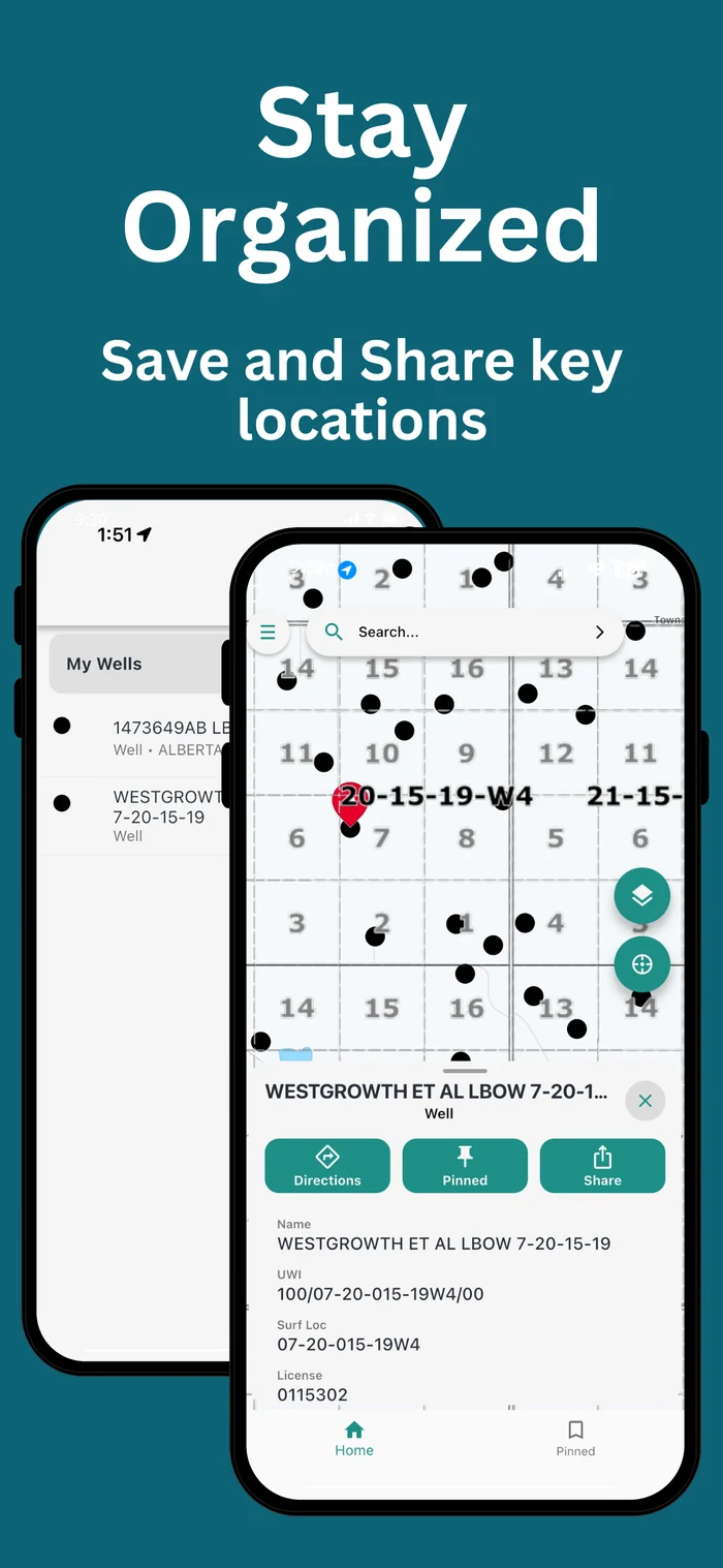
Designed for the Field
Save and group wells, switch between satellite and street views, and share locations with your crew. A fast, intuitive interface built for safety, speed, and real-world conditions.
Coverage Across North America
Current coverage includes 4 Canadian provinces and 17 U.S. states with region-ready offline maps.
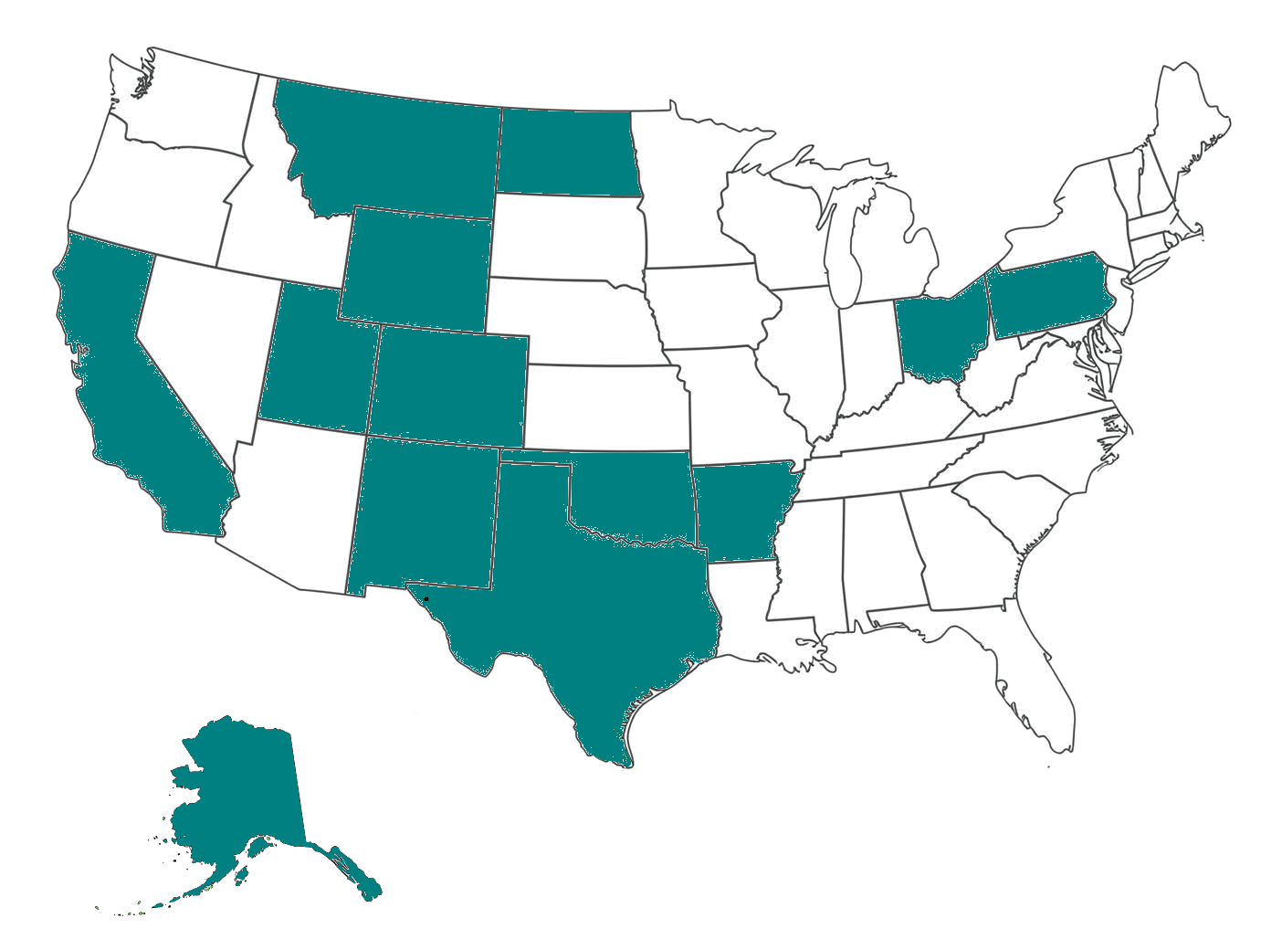
United States
17 states covered
Active coverage includes the major operating areas your crews are already driving in, with downloadable maps prepared by supported state.
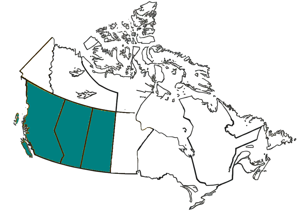
Canada
4 provinces covered
Canadian coverage is focused on the current provinces supported in-app, with downloadable regional maps built for low-signal field travel.
Need another operating area? Use the contact form to ask about regional coverage and upcoming availability.
Designed for Real Field Conditions
Every screen built with the oilfield worker in mind
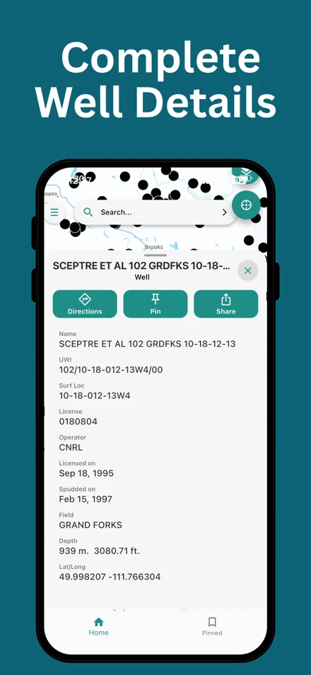
Complete Well Details
Access full well information including UWI, surface location, operator, and licensing data
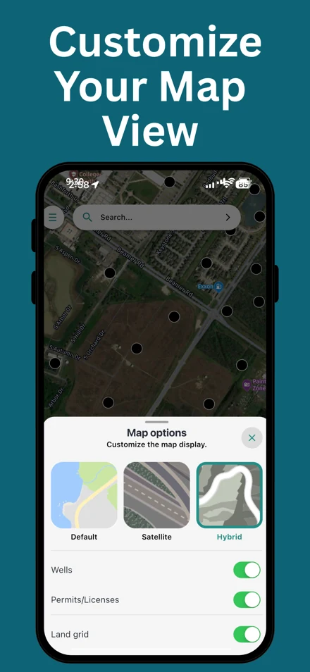
Customize Your View
Switch between street, satellite, and hybrid views. Toggle wells, permits, and land grid layers
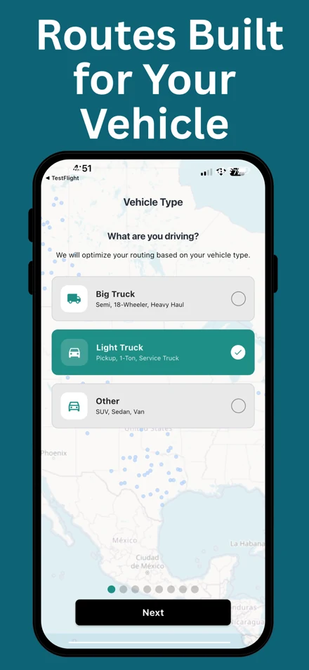
Truck Optimized Routing
Get routing optimized for your vehicle type — from pickups to heavy haul equipment
Simple, Professional Access
Choose the plan that fits your work schedule
weekly
Core tools for field work at a lower price point
- Online Well & land search
- Location sharing
- Professional well data access
- Built-in app support
- Offline navigation
- Vehicle-optimized routes
monthly
Core tools for field work at a lower price point
- Online Well & land search
- Location sharing
- Professional well data access
- Built-in app support
- Offline navigation
- Vehicle-optimized routes
yearly
Core tools for field work at a lower price point
- Online Well & land search
- Location sharing
- Professional well data access
- Built-in app support
- Offline navigation
- Vehicle-optimized routes
Why a subscription?
Essential and Pro plans include core field tools like well search, location sharing, and professional well data. Pro adds offline navigation and vehicle-optimized routing for teams working beyond signal coverage. Subscription pricing supports ongoing licensed map and data services so your crews always have up-to-date, reliable information in the field.
Built by the Creators of GeoActivity Well Finder
Developed by a team with proven experience building trusted tools for oil & gas professionals.
Industry Trusted
Relied upon by operators, engineers, and field crews daily
Proven Track Record
15+ years of experience in oil & gas software development
GeoActivity
A company dedicated to solving real field challenges
Latest Bulletin
The Hidden Cost of Non-Productive Time
How bad routes drain the bottom line through fuel waste, vehicle wear, overtime, missed service windows, and avoidable field risk.
Why it matters
Use this archive to surface launch notes, release changes, coverage updates, and practical field guidance.
Ready to Navigate with Confidence?
Join thousands of oil & gas professionals who rely on Oilfield Route to get to wellsites safely — and back home again.
Available on iOS and Android. Pick the plan that fits your field environment.